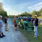
“A walk in nature walks the soul back home.” – Mary Davis
Of Beautiful Trail!
0Km
Horseback Riding
Snow-shoeing
Cross-Country Skiing
Snowmobiling
Walking
Hiking
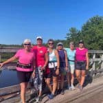
Cycling
ATV'ing
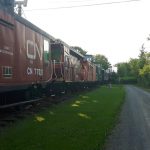
The Short Line Trail stretches 107 kilometers. This east-west portion of the Trans Canada Trail follows the former railway line along the North Shore and is continuous through three counties, Pictou, Colchester, and Cumberland.
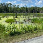
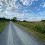
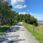
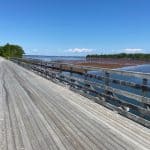
Great for bicycling or long-distance adventure, this flat gravel trail meanders through forest and farmland. It skirts many wetlands and crosses numerous streams, some with large sandstone culverts. Bridges span the Wallace River, French River, Waugh River and River John.
The 26 km portion lying within Colchester County, including Tatamagouche’s Butter Trail, is well maintained by the Tatamagouche Area Trails Association.
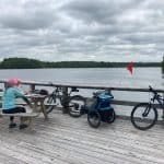
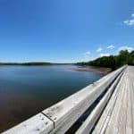
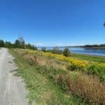
The trail section through Tatamagouche known as the Butter Trail (named after the Creamery), crosses the French River and Waugh River, passes by Patterson Wharf Park and through Nelson Memorial Park. It offers views of Tatamagouche Bay, and is within walking distance of village amenities.
Part of the Trans Canada Trail, the Short Line Trail connects our communities today as the railway did for nearly a century.
Scroll to the bottom of the page for an interactive map
The Denmark Segment
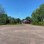
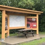
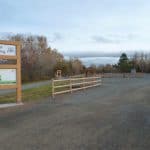
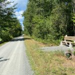
The Denmark Trailhead, across from the Sutherland Steam Mill, NS-326, has lots of parking, shelter, and an outhouse. Heading west towards Tatamagouche, the Short Line Trail meanders through forest, farmland, and wetlands. The Tatamagouche Trailhead is approximately 12 kms away.
To the east of the Denmark Trailhead is the Pictou County line, 3 kms. The Short Line Trail continues beyond the county line and is managed by the Pictou County Trails Association.
Points of Interest
Denmark Trailhead
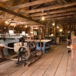
Sutherland Steam Mill
The Tatamagouche Segment
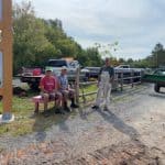
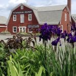
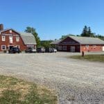
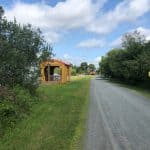
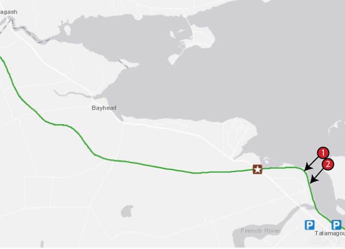
The Tatamagouche Trailhead, on Station Road next to the Train Station Inn offers lots of parking, a rest area, and an outhouse. This portion, the Butter Trail, runs along the waterfront, from NS-6 West to NS-6 East for 4.5 kilometers. It is close walking distance to the Village with many access points. Highlights along the trail include Waugh River Bridge, French River Bridge, Creamery Square, Patterson Wharf Park, Montbeliard Cemetery, and the Nelson Memorial Park.
Points of Interest
Waugh River Bridge
Tatamagouche Trailhead
Creamery Square
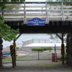
Patterson Wharf Park
French River Bridge
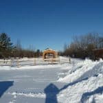
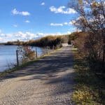
The Bayhead Segment
The Bayhead Segment starts at the Nelson Memorial Park where you will find lots of parking, picnic areas, and seasonal washrooms. The beautiful tree-lined nature trail continues west for approximately 2 kilometers to NS-6, and onward to the Cumberland County Line for approximately 10 kilometers. Beyond the county line, the Short Line Trail is managed by the Cumberland Trails Association.